
Assess your property portfolio’s development potential with AIM
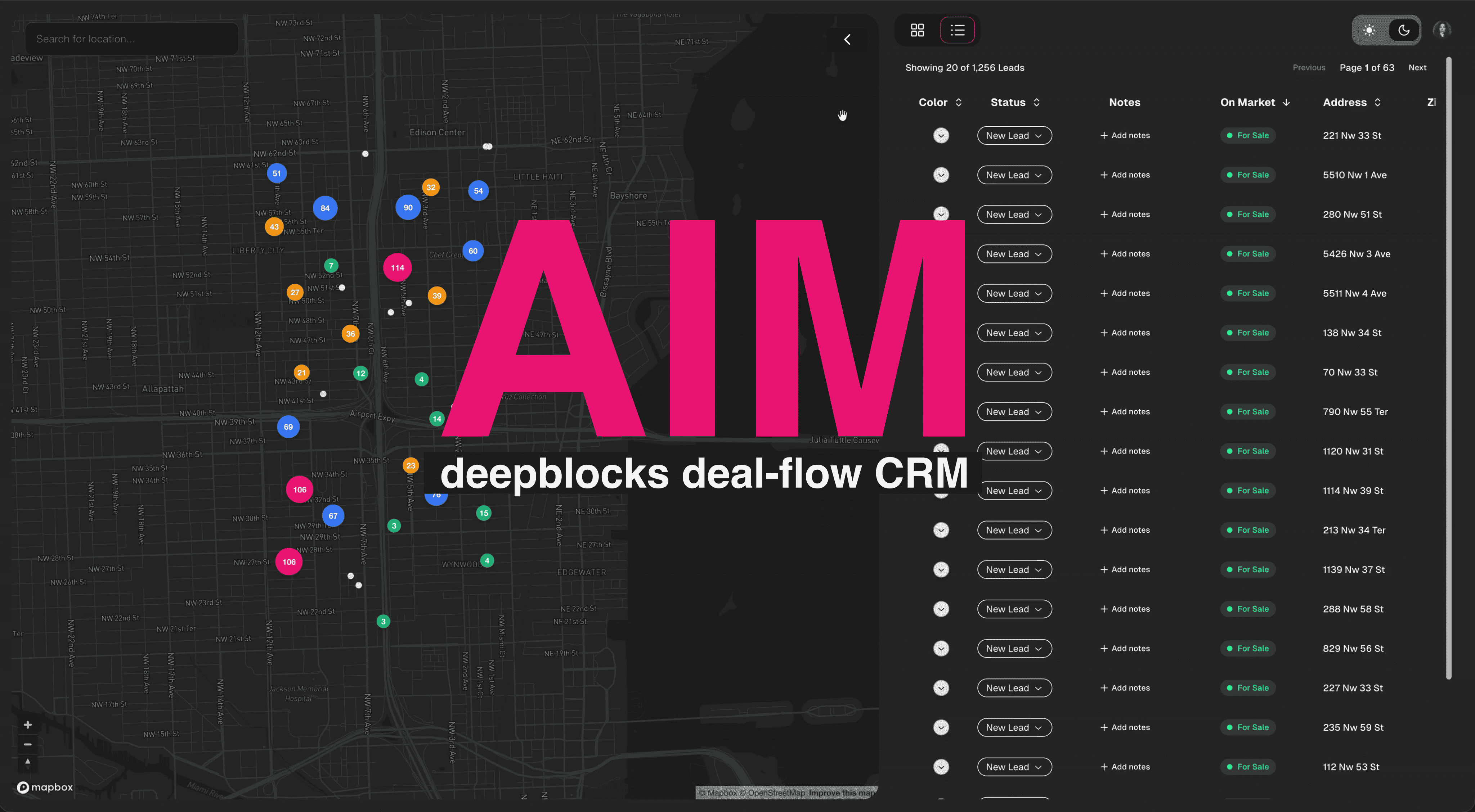
We’ve added a way to review your portfolio’s zoning capacity in AIM. Send a list of addresses or folios (property identification numbers), and AIM maps the sites. You can inspect individual property records and search within your list by development capacity and proximity.
Explore AIM to find sites at city scale: Ask in plain language and see matches.
Find properties that match a project size
In the recording, folios for 25 parcels in Delray Beach are supplied in one message. AIM maps the parcels. Selecting a site opens its record, including its zoning district, existing units and by-right unit capacity.
The follow-up asks which of those parcels have capacity for 10 to 20 residential units by right, under the base zoning. AIM reports one match, 280 NE 2nd Ave, and updates the map to show it.
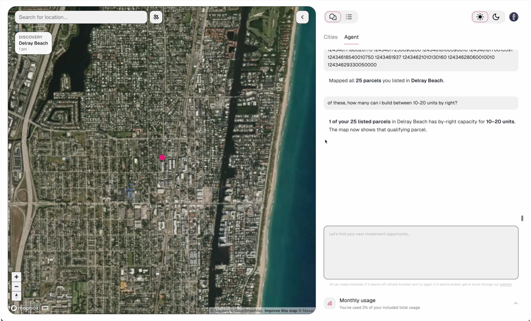
AIM reports one match within the supplied list for the requested unit-capacity range.
Compare existing development with zoning capacity
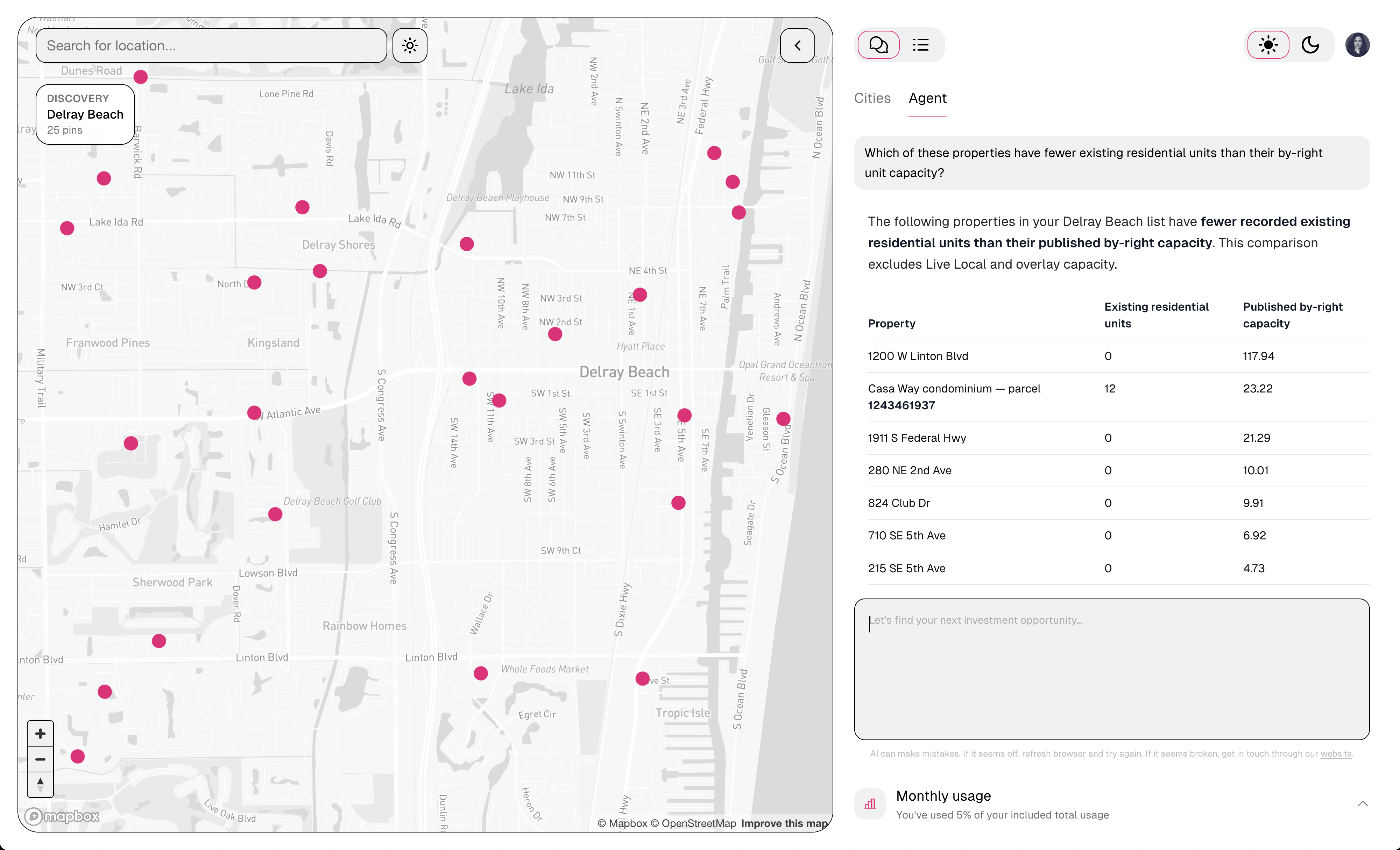
In this example, the query asks which listed properties have fewer existing residential units than their by-right capacity. AIM returns a table comparing recorded existing residential unit counts with by-right capacity for the listed matches.
The table includes 280 NE 2nd Ave with zero existing residential units. Its property record in the video lists an office use. An owner can use this comparison when investigating underutilised properties, including commercial holdings with potential residential capacity.
The comparison shows existing residential unit counts alongside by-right capacity.
Find properties near transit
The next question asks which properties are within half a mile of a transit stop. AIM asks whether to check the original 25 properties or the properties from the unit-capacity comparison. The reply selects all 25.
AIM reports that 20 of those 25 parcels are within half a mile of a transit stop and updates the map to show those 20. For an owner planning housing near transit, the search identifies which of the supplied sites meet that location requirement.
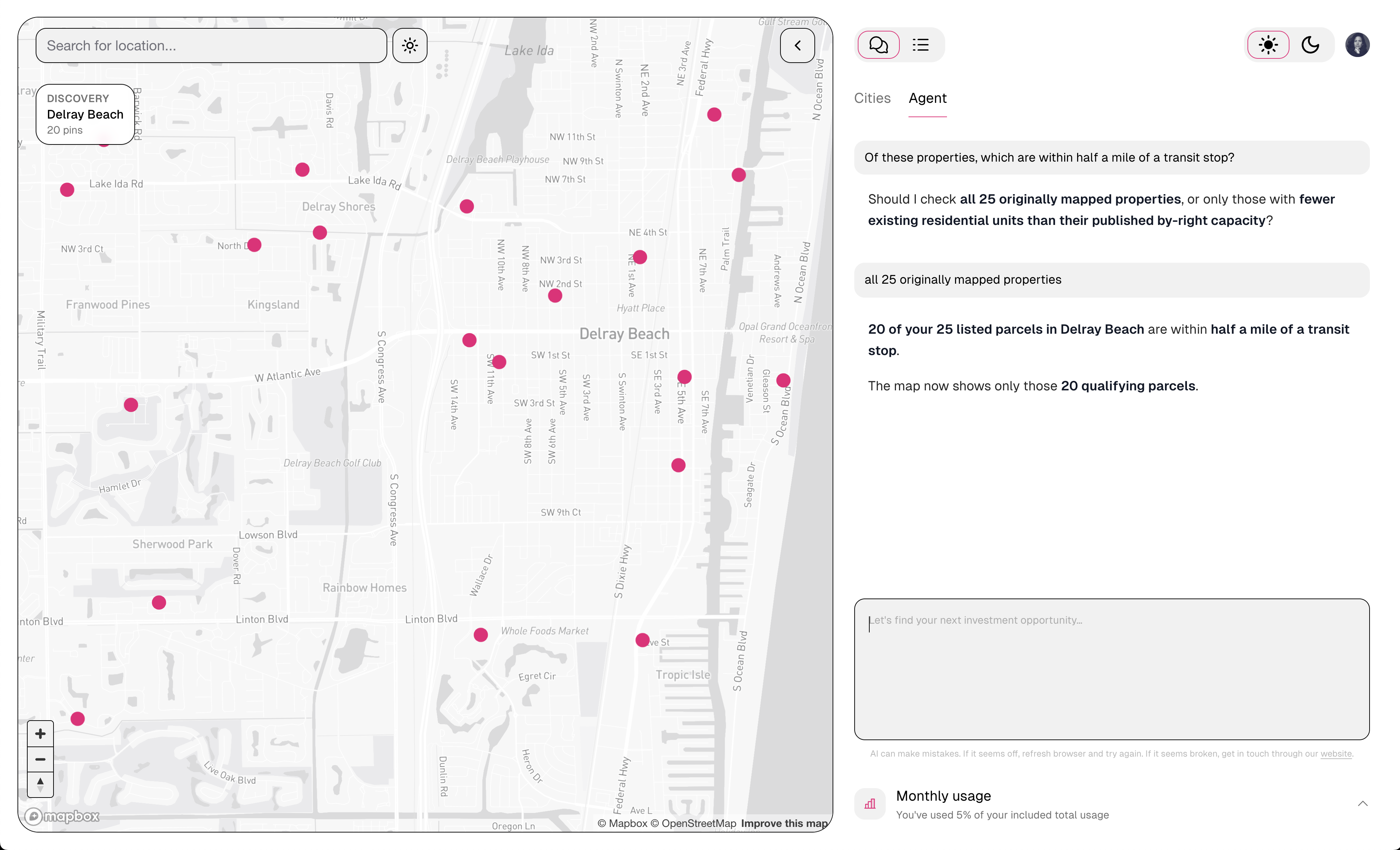
The transit search covers all 25 originally mapped properties and returns 20 reported matches.
From zoning capacity to a development decision
Subtracting existing units from zoning capacity does not establish how many homes could be added alongside an existing building. A residential redevelopment study needs to account for the existing property, test how a building fits on the site, and assess development costs and expected income. The owner can then decide whether the proposed project is worth pursuing.
Explore AIM to find sites at city scale: Ask in plain language and see matches.