
Three answers for one lot in Delray Beach
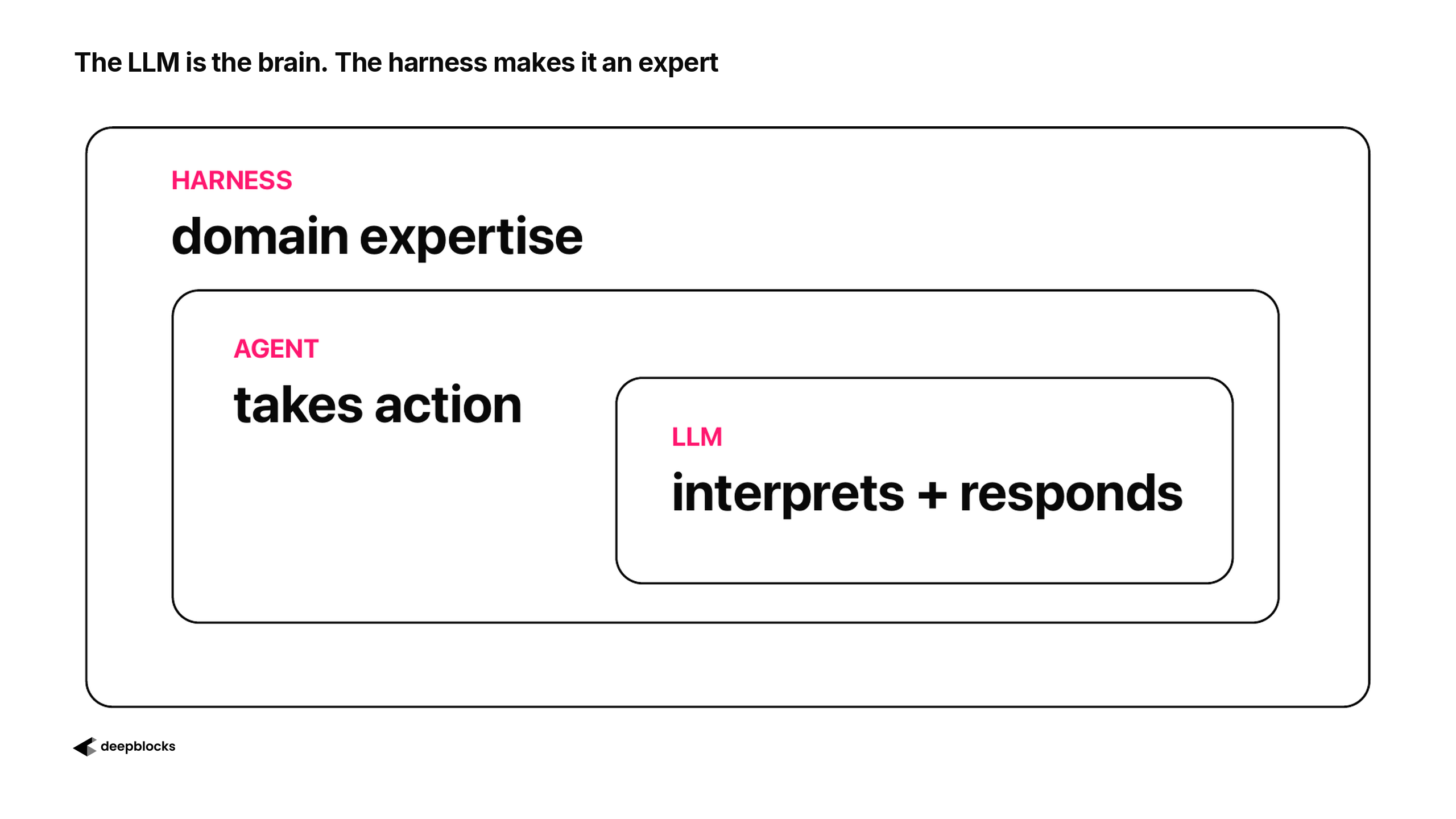
A model on its own gives you what it has read, phrased well. A harness gives the model the facts of one field. One address, 1405 N Federal Hwy in Delray Beach, Florida, asked what can be built on it three ways, shows the difference.
Explore DEV to prove if a site pencils: Drop a pin, model in 3D, and watch returns move.
A search overview answered with the listing
I typed "what can I build on 1405 N Federal Hwy, Delray Beach, FL?" into a search engine. The AI overview at the top of the results answered: "You can build a three-story residential building with nine high-end luxury condominium units, as the property features pre-approved plans and architectural renderings for this specific project." Under "Approved Project Details" it listed 3 storeys, 9 ultra-luxury residences of approximately 2,500 square feet, a resort-style pool, and a 0.15-acre lot about a mile from the beach. The sources were an Instagram account, a builder and a brokerage.
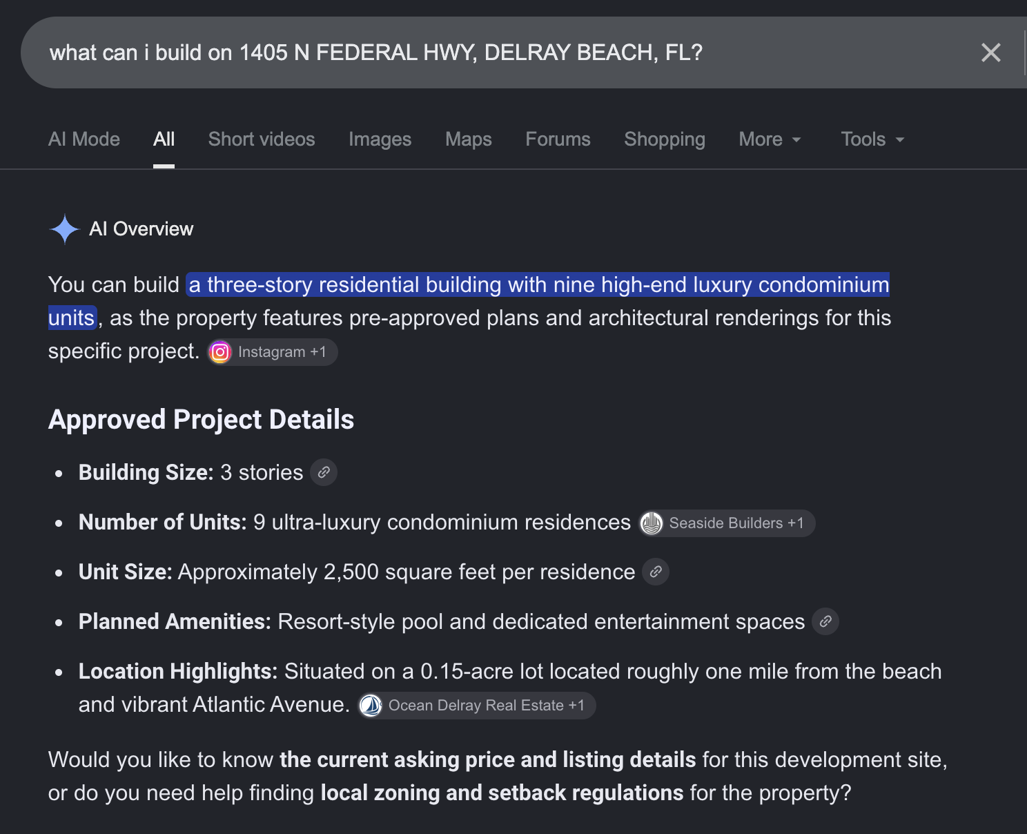
The search engine's AI overview, as returned.
Every line came from the marketing of a project someone once proposed on the site. The overview reported the marketed project as the answer to what the lot allows, then offered the local zoning and setback regulations as a follow-up.
A general model was careful, and still had no number
I asked a general model the same question. It worked for ten minutes and three seconds and came back with the same nine-condominium project, The North Edge, and with a correction: the project covers a three-parcel assemblage, not the single parcel at this address. Its sources were the county appraiser's record for the parcel (General Commercial, 0.13 acres, classed as vacant), the city's application, which lists three parcel numbers, and the same builder's marketing the overview had used. It wrote: "I would not assign the nine-unit development potential to the 0.13-acre parcel alone."
It listed four development options to evaluate (the combined-site project, another multifamily project, retail or office, mixed use), noted that the list was not a finding that every option fits the single parcel, and said a freestanding multifamily building in General Commercial needs conditional-use approval. It stated what it had not established: the parcel's maximum height, floor-area ratio, setbacks, required parking, or maximum unit count. It flagged two right-of-way dedications that could change the acreage. And it ended with a question back to me, whether I meant the full three-parcel site or the one parcel.
That answer is careful. It read the county record, the city's agendas and the marketing, and kept them apart. What it did not produce is a by-right number for the lot I asked about.
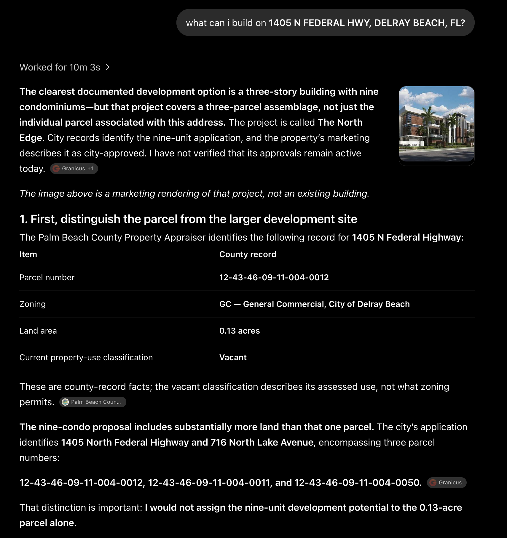
The general model's answer, part 1 of 3: the parcel and the assemblage.
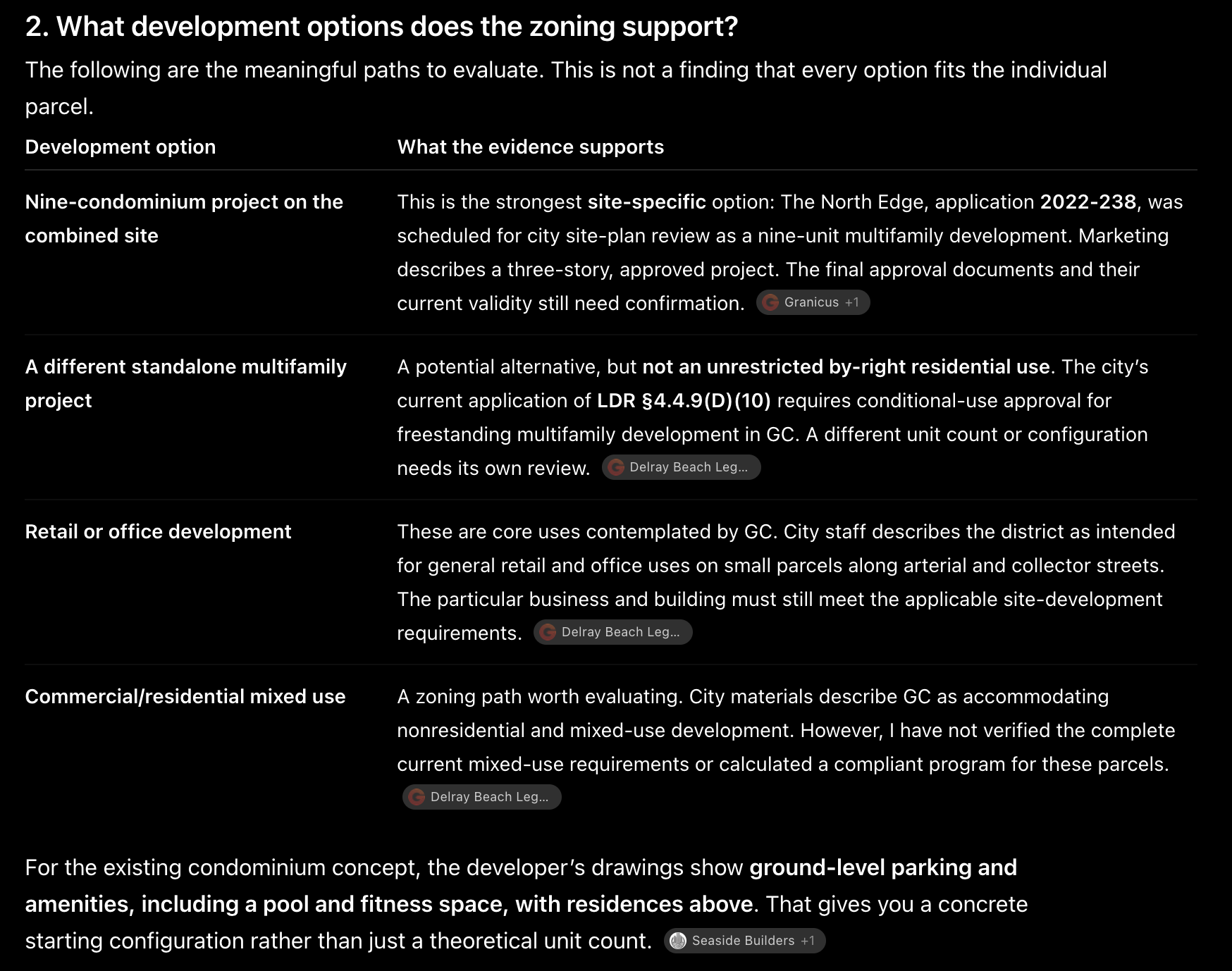
Part 2 of 3: the paths the zoning supports.
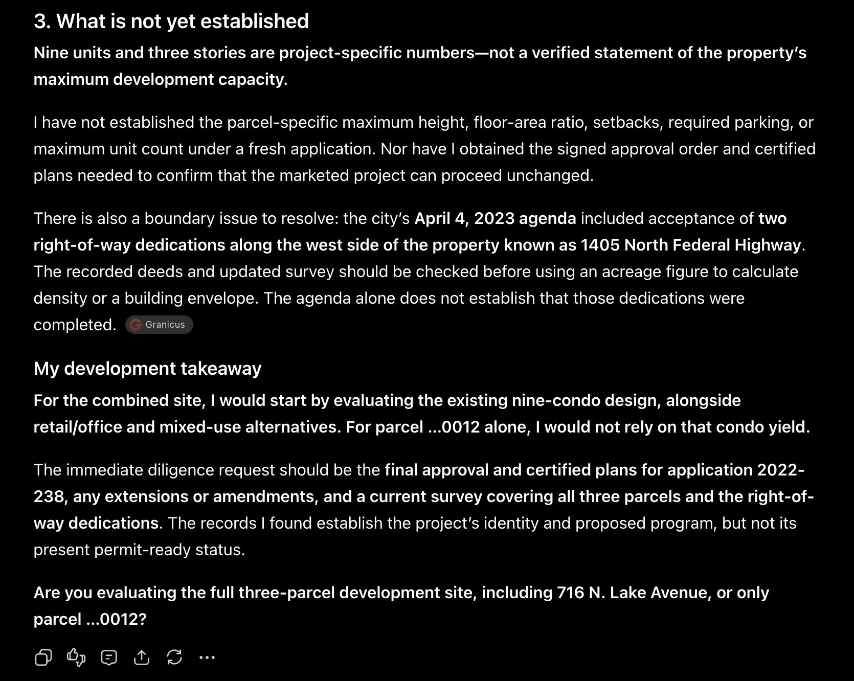
Part 3 of 3: what was not established, and the question back.
Parcel-finder answered from the parcel record
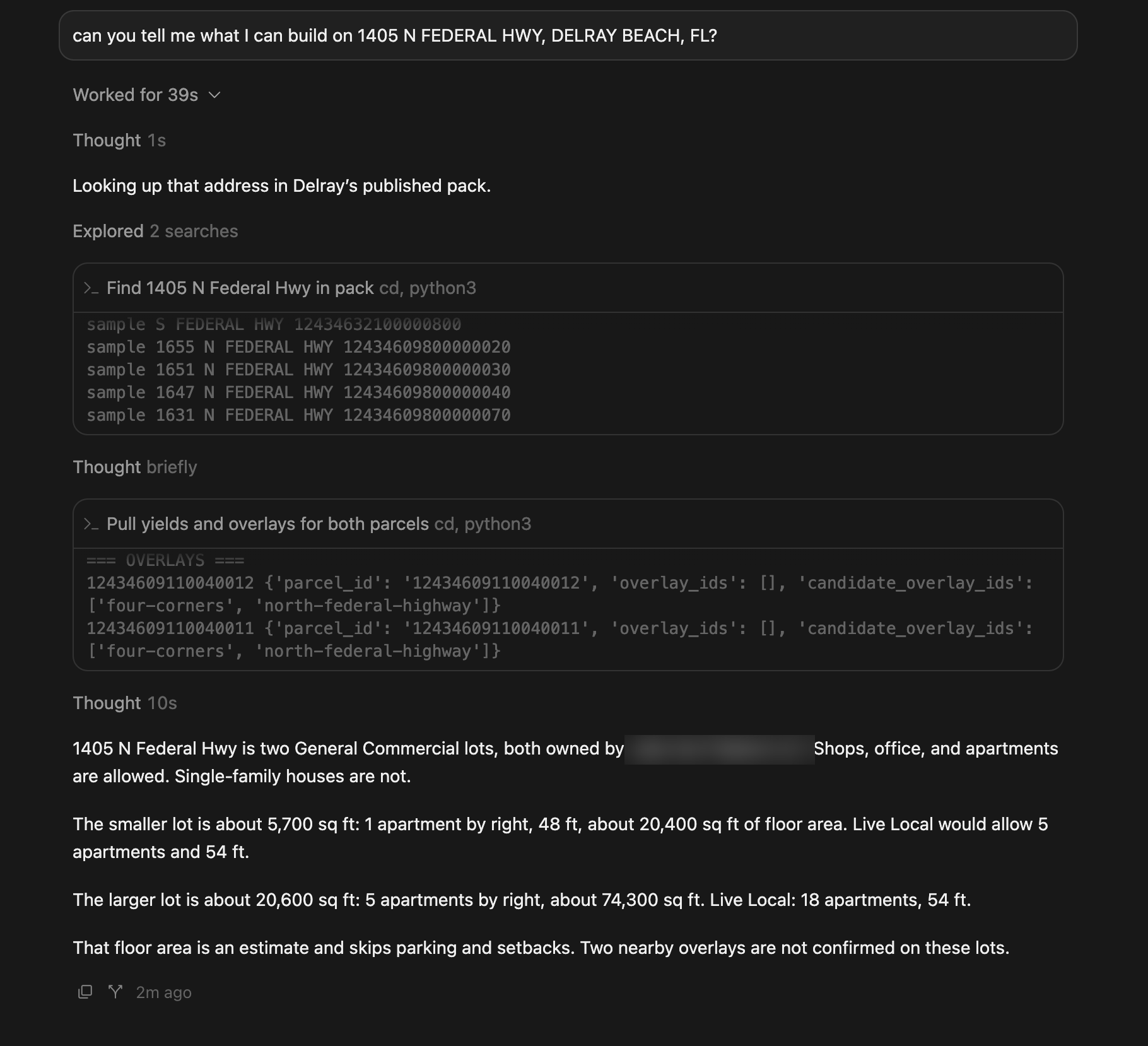
I asked parcel-finder, the zoning infrastructure that Deepblocks products query, the same question. It did not open a web page. It looked the address up in the Delray Beach parcel record it had already built, pulled the yields and overlays for both parcels, and answered in 39 seconds.
The address is two General Commercial lots under one owner. Shops, offices and apartments are allowed. Single-family houses are not.
Smaller lot, about 5,700 sq ft: 1 apartment by right, 48 ft, about 20,400 sq ft of floor area. Under Live Local, 5 apartments and 54 ft.
Larger lot, about 20,600 sq ft: 5 apartments by right, about 74,300 sq ft of floor area. Under Live Local, 18 apartments and 54 ft.
(Live Local is a Florida state programme that raises what a lot allows for projects with an affordable-housing commitment.)
Then its own caveats, as it stated them: "That floor area is an estimate and skips parking and setbacks. Two nearby overlays are not confirmed on these lots."
Parcel-finder's answer in 39 seconds. Owner name blurred.
The smaller lot is the parcel in the county record the general model cited: 0.13 acres is about 5,660 sq ft. The general model and parcel-finder agree on the district and on the lot. Only parcel-finder returned what the lot allows.
An article read as fact, or an ordinance read as data
The three answers differ because of what each tool read, and what each tool did with the pages it read.
The search overview read the pages about the address: a listing, a builder's Instagram account and a brokerage. So the answer was the listing.
The general model read the same marketing, and more: the county appraiser's record and the city's meeting agendas. It kept the parcel apart from the assemblage, which the overview had not. But its answer was still built around the marketed project. Its first line was "The clearest documented development option is a three-story building with nine condominiums". The unit count and the storeys came from the builder's marketing, the same source the overview used, and the rendering at the top of its answer was the builder's. Its list of what the zoning supports was a list of uses, not of numbers. Ten minutes of reading about the parcel, and the maximum for the lot was still "not established", because nothing it read had applied the ordinance to this lot, and it did not apply the ordinance itself.
Parcel-finder had already done that work, before I asked. When we prepare a city, parcel-finder gathers its parcel data, zoning map, ordinance, overlays and state law, joins each parcel to its district, applies the district's rules to the parcel's facts, and traces each value back to the provision that set it. The result is one record per parcel, for every parcel in Delray Beach. My question was a lookup against that record: two lots, their district, what each yields under the base district and under Live Local, and the overlays near them. The caveats came from the record too: the floor area is calculated before parking and setbacks, and two overlays sit near the lots without being confirmed on them. I asked what can be built, and an answer to that question is what came back. The parking requirements, the setbacks and the overlays are in the same record.
The record, the yield logic, the lookup and the caveats are what a harness supplies. The context is the parcel record. The instructions are how a yield is calculated in this district. The tools are the lookup and the calculation. The checks are what the record is sure of and what it is not. The general model read about the parcel. Parcel-finder read the ordinance, once, as data, and applied it to every parcel in the city.
What a developer does with each answer
With the overview, a developer underwrites nine condominiums on one lot. By the city's own application, the project covered three parcels. The price paid follows from a capacity the lot has not been shown to have.
With the general model's memo, a developer has a diligence list and no number. The next step is to open the ordinance and read the district, or to pay a zoning attorney to do it.
With parcel-finder's answer, a developer has a by-right count and a Live Local count for each lot, a height, an estimated floor area, and a plain statement of what the estimate leaves out. The parking requirements, the setbacks and the overlays are in the same record, and parcel-finder returns them when asked. What is left for the developer is the decision: which lot, which path, and whether the deal works.
Explore DEV to prove if a site pencils: Drop a pin, model in 3D, and watch returns move.